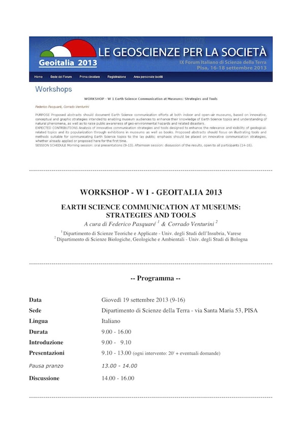
EARTH SCIENCE COMMUNICATION AT MUSEUMS: STRATEGIES AND TOOLS
Scarica il file pdf
Riassunti delle presentazioni
(in ordine alfabetico)
Arena L.P. (2013) – The IGS project: on the steps of scientist-voyagers of the past. New tools and strategy for a Historical Geotourism.
Keywords: geotourism, history, geoscience
Defined as “Tourism that sustains or enhances the geographical character of a place, its environment, culture, aesthetics, heritage, and the well-being of its residents”, the Geotourism could be considered a kind of Green Tourism, whose purpose is the valorization, protection and mediation of the geoheritage and geoscience.
Today in Italy we have many projects and associations that are dealing with Geotourism since many years, such as the projects concerning the mountain routes (Via Alpina ,Via Adventure, Iron Route, Via Geoalpina) or the associations like Geoturismo and Geologia e Turismo.
However, the historical aspect has been only partially explored so far. The recent IGS Project (Geo- Historical Routes) aims to make the historical element the “adhesive” force for the valorisation of land peculiarities. By means of four working groups (research, informatics, communication and didactic public outreach and teaching, guides) this project plans to create geo-historical touristic paths, both digital and real.
Such paths are reconstructed through a solid work of historical research and traveled through again following the same steps originally taken by the scientist-voyagers of the past, which gave a significant contribution to the development of geosciences with their field activities.
In particular, diaries, letters and primary sources of the 18th and the 19th century are a precious cultural heritage of geo-mineralogical knowledge about the practice of travel and could be use today for the enhancement of the Geotourism.
Thanks to this kind of digital paths, the tourist users might be brought to the knowledge of what was known in the past putting it in relation with the current knowledge. Through the use of Google Earth application, it could be possible to compare the historical maps with the current ones, tracing the path followed by the scientist-travellers, identifying places and points of interest litho-geo-mineralogical and so on.
This interactive tour could be enriched by a number of other geological and cultural information and by the use of technological tools like the GPS system that could give the opportunity to create a geo-located paths.
To achive this goal, the keyword is Synergy. The added value of the IGS Project is, in fact, the integration of different skills (historical, geological, cartographic, administrative and computer science) able to link the net with the needs of the territorial development and the promotion of Geotourism and Educational tourism.
Baucon A., Venturini C. (2013) – Translating rock language to the lay public through multimedia and interactive tools: an ongoing exhibition in the Carnic Alps
Keywords: augmented reality, exhibition, geological heritage
This contribution illustrates the educational and museological strategies employed in an ongoing geological exhibition planned under the auspices of Comune di Pontebba (UD). The focus is on the Pramollo area, which is characterized by a diverse and well-exposed geological heritage, including sedimentological (Carboniferous succession), palaeontological (body, trace fossils), tectonic (Alpine thrusts) and geomorphological (glacial, fluvial, karstic landforms) aspects. The exhibition covers a 106 m2 indoor area and benefits of two classes of interactive tools:
1) Augmented reality installations enhance the visitor’s experience of geological samples by merging physical reality with computer-generated content;2) Palaeolandscape installations display scenarios and organisms which react to the visitor’s position and actions. Samples (fossils, rocks) and explanatory panels complement the mentioned digital tools, balancing the virtual with the physical world. In this regard, explanatory panels make extensive use of the all inside image strategy and utilise the geological conceptual grid to better convey information.
Candela A. (2013) – Mining history and geoparks: a case study in the Western area of Lombard Prealps
Keywords: mining history, geoparks, cultural heritage
In the 18th and 19th centuries, there was a considerable development in mining activities in different regions of the Italian peninsula. Indeed, especially in the second half of the 18th century, a renewed interest in the exploitation of mineral deposits, due to a growing demand of metals all over Europe, caused the gradual reopening of several ancient mines.
For these reason settlements were established near mining sites, particularly in proximity to the Alps. Using various types of data and sources, both historical and archaeological, it is possible to reconstruct the history of these peculiar anthropical environments, on the basis of the geo-lithological and morphological features of given areas.
Moreover, historical sources are important tools for the recovery and re-evaluation old mining sites, as well as for the reconstruction of the evolution of specific landscape in the broader spectrum of historical and technological trends. This paper examines a single case study, still poorly understood, concerning the mining deposits in the Pre-Alps of Western Lombardy.
The hill of this area cannot be historically considered a remarkable mining district, such as the better known eastern mountain regions of Lombardy, nevertheless, excavation activities shaped this slopes of the Pre-Alps with distinctive infrastructures which still exist.
This type of research represents an interesting way of increasing the environmental riches and cultural heritage of the Alps, through the establishment of mining parks, Geoparks and naturalistic or historical routes.
Caramelli A., D’Addezio G. (2013) – MegaPiramide3D, an innovative tool for Earth Science communication
Keywords: innovative exhibit, 3D stereoscopic, virtual image
The MegaPiramide3D is an innovative exhibit created to enhance Earth Science topics through exhibitions. We designed the exhibit to capture the visitor attention in scientific phenomenon with 3d vision, conveying scientific information through emotion to improve the transfer of educational information.
The MegaPiramide3D is a truncated pyramid with reflective faces with a 3d rear projection screen (horizontal) in the upper part. The first prototype has been exposed in Florence as part of the exhibition “Dal Cielo alla Terra”. The MegaPiramide3D looks like a large installation height of 3 meters. Through polarized glasses is possible to see three dimensional images or real models thanks to an “optical switching”. Inside the exhibit you can see in the same volume:
- 3D stereoscopic virtual image (visible with 3D passive polarized glasses); – Real objects; – 2D rotation images into pseudo 3D view (visible without 3D glasses). The display can be exclusive (one of the three effects listed above) or a “mixture” between real and
virtual where it is hard to understand where one ends and the other begins. The mixing of the virtual images to the real ones is obtained through a progressive optical switching using a particular semi mirror: varying the brightness of strong lights inside you can make it transparent or reflecting, allowing whether or not the vision inside.
The semi-reflective films used are special mirrors developed by an Italian company in collaboration with the INGV, consisting of a special metallic semi-reflective film (called Mirror3D) prepared on aluminum frames. The “Mirror3D” film keeps the polarization plane during reflection, necessary for 3D viewing for both linear and circular polarization.
The film Mirror3D prevents most of the external light to enter inside vanishing the vision of objects inside. In the case of lights out inside, only what is displayed on the horizontal screen in the upper part will appear inside the pyramid with an effect three-dimensional guaranteed by polarizing filters.
By synchronizing the virtual images with the partial lighting of the lights inside you can optically mix virtual images with real objects alternating virtual images tot real objecs (for example, a real model volcano combined with virtual 3D lava running down the slopes)- . Decreasing the lights inside you can make disappear the real object leaving only the virtual images (for example depicting the interior of the Earth).
Conz E., Denicolai S., Riccardi M.P., Zucchella A. (2013) – “Sentire la Pietra”: the economic and cultural role of ornamental stones in Piedmont region (Italy)
Keywords: ornamental stones, scientific museum, historical memory
Today cultural heritage is no longer considered like a historical, artistic and architectural object of interest, but also an evidence of economic, cultural and social activities of a country. An ornamental stone is one of these evidences and could be consider “Cultural heritage”.
In Piedmont region (Italy) there are few local museums that illustrate the material and immaterial value of the stone, like usage and processing. They are called eco-museums and their aim is to preserve, protect and show frameworks of traditional society, in order to pass on the traditions of local country people. They are generally financed by the city council, and their maintenance is mainly based on local people’s charity and availability.
In Piedmont region there are some museums that preserve the historical memory, furthermore the whole city of Turin is an “open museum”, where anyone can admire 150 kinds of ornamental stones, all quarried out in Piedmont. The ornamental stones perfectly describe the town’s identity and are historical and artistically precious.
Several studies have been carried out to investigate social and economical effects of the creation of a “Stone path” through the streets of Turin, with information panels, supported by new smart and sharing technologies, where citizens, tourists and even children, can appreciate the historical description of buildings and of the ornamental materials too. This path could be part of a wider project including a stone museum called “Museo della pietra”.
The main idea is based on a scientific museum, where technical and scientific information (i.e. extraction process, petrographic characteristics, transport and installing methods) are shown as the historical ones, by the exposition of historical pictures and video of craftsmen daily life.
The project called “Sentire la Pietra” could be a new way to create a network, composed by the stone city path, the eco museums and the main museum where reconstructing the local social life, telling a story through the technical and historical description of ornamental stones in Piedmont.
Giardino M., Lozar F., Magagna A., Perotti L., Rapisardi E., Di Franco S. (2013) – GeoMedia-web: multimedia and networks for dissemination of knowledge on geoheritage and natural risk
Keywords: earth sciences, multimedia, web
Geological knowledge is fundamental not only for successful exploration and management of georesources but also for assessment and mitigation of natural risks. The GeoMedia-web project (Accordi di Programma e Intese – L.6/2000 D.D. 369/Ric/26-06-2012) aims to establish a network of researchers, teachers, and scientific popularisers sharing innovative multimedia solutions for dissemination of Earth Science contents.
Through the enhancement of awareness on geodiversity we pursue to highlight evidences of past environmental changes and evolutionary processes, and also to reveal information needed for more accurate prediction of future environmental changes, related risks and for adequate adaptation plans and/or prevention measures.
The GeoMedia-web concept is based on principles of geoconservation and virtual reality applications developed by several projects throughout the world. By means of collaborative creation and sharing of dissemination products, in our country we want to fill the gap between these theoretical frameworks and their effective application in geodiversity action plans, and in the proactive management of natural risks. GeoMedia-timelines proposes the application of a balanced mixing of Earth Sciences knowledge, ICT instruments, geoethical principles and innovative didactic methodologies for:
- Individualizing outstanding examples of geological heritage and natural risks at different scales, elaborating and testing real and virtual field trips and “timeline-based experiments” for visual representation of geological processes and present/past evolutionary scenarios of landscapes;
- Offering a shared and targeted fruition of the above interactive products to schools (K12 to high schools) and the general public, through workshops, lectures, and cultural events.
All these goals will be accomplished by a multidisciplinary working team of Earth Sciences and Informatics researchers (GeoMedia-team), in cooperation with a multiscale (local, regional, national, international) network of schools, governmental institutions, cultural associations, and museums (GeoMedia-network).
GeoMedia-web will be federated with other initiative for the diffusion of geological culture presented by other national institutions. Shared activities at a national level aim to:
- Stimulate greater and more widespread skills among students, in line with the Europe 2020 objectives for science;
- Contribute to the training of teachers, through the spreading and collaborative testing of appropriate didactic techniques, practical support and information and communication technologies;
- Promote a widespread and deep culture of natural risks, based on the knowledge of: natural processes, hazards inherent in the geological asset of an area, responsible urban development, perception of the environmental changes as part of the dynamics of the Earth, with which it is necessary to live responsibly and consciously.
La Longa F., Lanza T., Crescimbene M. (2013) – Ecomuseum: telling Earth Sciences through the territory
Keywords: ecomuseum, outreach, educational methodologies
The ecomuseum is a revolutionary concept compared to traditional museum because it adds to the traditional museum the social dimension. The environment is described through history, culture, landscapes, activities, society putting in relation to aspects of life, material and spiritual, and tying them to the places, territories and the culture that created them.
The experience described refers to the realization of the pilot project “Towards an Eco Museum of the Castelli Romani”. The project, proposed and implemented by a group of researchers of the Laboratory of Education and Science Communication of Istituto Nazionale di Geofisica e Vulcanologia (INGV) in collaboration with the Regional Park of the Castelli Romani, involved students of the Classic and Socio- Psycho-Pedagogical High School of the Mancinelli Falcone Institute of Velletri (RM).
The work here proposed is an example of how to promote knowledge, awareness and appreciation of its territory by use of innovative and multidisciplinary educational programs; paths that allow young people to redraw the places to returning them to the communities that live there as a common heritage to be lived and protect.
Educational activities carried out in the academic year 2009-2010, were structured on multidisciplinary training programs designed to create ecomuseum routes. These training programs have been grouped into three main areas (historical, archaeological and literary, geological and town planning, ecological and naturalistic) that are particularly representative of the complexity of geological and anthropological territory of the Nemi Lake.
Very often the age of globalization takes us to lose sight of the concept of place in favour of the non- place, an environment free of characteristics and boundaries. This trend, if on one hand helps to share problems and solutions related to environmental protection, other hand risks producing a variety of effects that lead communities to disown the values of their territory.
Instead the experience realized takes us in an opposite direction. The active techniques used in the project (dramatization, creative writing, music, etc.) favoured boys in the acquisition of knowledge and skills that allow enhance of territorial resources and sharing it with the community.
Another innovative element of the project is the setting methodology on which it was built, which places the school world not as the final recipient of knowledge but as a viewer and at the same time a partner who takes an active role in the dissemination of knowledge .
Pasquarè F., Venturini C. (2013) – Innovative strategies to maximize the educational value of Earth Science exhibition panels
Keywords: museum, panel, strategy
Museums are commonly packed with collections, exhibited objects and images, the illustration of which requires explanations that go far beyond the mere denomination of a specimen or the general description of a situation. The most common tools for achieving the goal of attracting museum visitors are explanatory panels.
A frequently used practice among museum exhibit curators – particularly in Italy but also in other countries – is to come up with panels that are often clogged with words, as if they were chapters of books or pages of an encyclopaedia.
This in turn brings about an “information clutter effect” that will leave visitors confused and frustrated. Moreover, the wordy and long-winded explanations are often only cryptically related to the exhibits or images they are designed to illustrate.
To make the most of the educational potential of Earth Science museums, we hereby propose the use of two different strategies: The former employs the so-called all inside images, aimed at minimizing text length; the latter is intended to improve the graphic layout of panels, which need to be planned in a modern and attractive way.
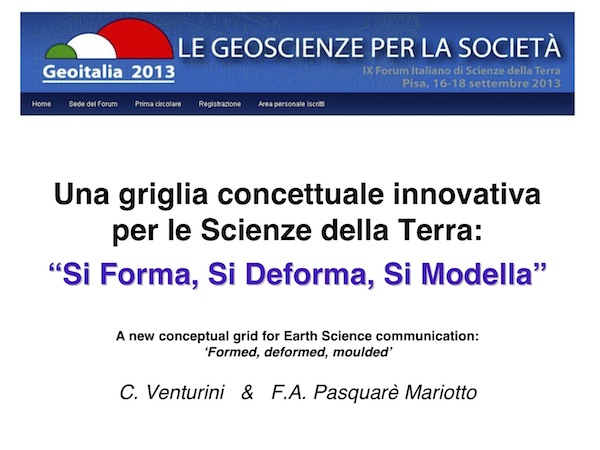
Venturini C. , Pasquarè F. (2013) – A new conceptual grid for Earth Science communication: ‘formed, deformed, moulded’
Keywords: sustainable, conceptual, grid
Scarica il pdf della presentazione
Earth Sciences offer unimaginable inspiration to those interested in science education and popularization. However it is often hard trying to describe the evolution, through geological time, of a given territory. This is especially due to the superposition, in the same area, of multiple effects related to quite different processes.
With the purpose of ensuring sustainable information – i.e. to provide contents that are easily understandable by the lay public – such complicated concepts need to be simplified without being trivialized.
This goal can be pursued through the elaboration and use of a conceptual grid capable of tying together different, multidisciplinary information. The grid has be able to split all crustal phenomena into a few (no more than three), well understandable, sets of effects.
As the use of technical jargon borrowed from geology, such as litho-, tecto- and morphogenesis needs to be avoided, we propose to describe all processes related to the formation of rocks, their deformation and successive erosion, by means of a combination of concepts related to the following words: formed, deformed and moulded.
Potresti leggere anche:
: un’evoluzione guidata da tettonica, glacialismo e sismicità") Conoide dei Rivoli Bianchi di Tolmezzo e paleo-Lago di… Questo contributo prende in esame i caratteri geologici e soprattutto geomorfologici del settore alpino ubicato a NE di Tolmezzo (UD), comprendente i Monti Strabut, Amariana e Palavierte p.p., nelle Alpi Carniche centrali. L’indagine inizia trattando la stratigrafia del substrato e…
Conoide dei Rivoli Bianchi di Tolmezzo e paleo-Lago di… Questo contributo prende in esame i caratteri geologici e soprattutto geomorfologici del settore alpino ubicato a NE di Tolmezzo (UD), comprendente i Monti Strabut, Amariana e Palavierte p.p., nelle Alpi Carniche centrali. L’indagine inizia trattando la stratigrafia del substrato e… Geo-escursione sul Medio Tagliamento Domenica 19 maggio 2024 - Societat Filologjiche Furlane, setemane de culture furlane; Festival delle Filande: incontri tra generazioni. Carpacco-Cornino-Pinzano 9.30-16 (con mezzi propri; partecipazione libera e gratuita).
 Geo-chiacchierata “Pericolosamente Timau!” Venerdì 23 agosto 2024 [18.30-19.30]. Timau (UD), sala Pio X (Piazza S. Pio X, accanto al Museo della Grande Guerra).
 Geo-escursione “Alta Valle del But” Venerdì 23 agosto 2024 [10.15-18] - CAI-Sezione di Ravascletto (UD). Itinerario di massima: Paluzza-Cleulis-Timau-Laghetti di Timau (vedi Locandina). Escursione gratuita, trasferimenti con mezzi propri. A seguire la geo-chiacchierata "Pericolosamente Timau!" (18.30-19.30), v. Locandina specifica.
 – Alla scoperta degli antichi vulcani della Carnia (M. Dimon)") XXV GEODAY (l’ultimo!) – Alla scoperta degli… Sabato 24 agosto 2024 [9.45-18] - Itinerario di massima: Cleulis (UD) - Casera Pramosio (con mezzi propri) - Crete del Mezzodì - Monti Paularo e Dimon - Lago Dimon. Dislivello a piedi: 500 m (vedi Locandina). Escursione gratuita.
XXV GEODAY (l’ultimo!) – Alla scoperta degli… Sabato 24 agosto 2024 [9.45-18] - Itinerario di massima: Cleulis (UD) - Casera Pramosio (con mezzi propri) - Crete del Mezzodì - Monti Paularo e Dimon - Lago Dimon. Dislivello a piedi: 500 m (vedi Locandina). Escursione gratuita.